


The route from Battlebox HQ to Admiral Chan's Head Office on the 2nd floor of Shell House

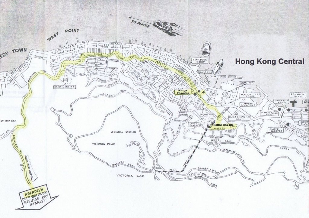
The route from Central Victoria out to Aberdeen
Aberdeen Channel where the Cornflower launch was alongside the jetty next to Hope Dock

Below is an aerial photo of the Western end of Ap Lei Chau or in English Duck Tongue Island opposite Aberdeen Harbour on the left where the Cornflower launch set out from.

Top center is Staunton Creek, and top right is Aberdeen Channel South, leading down to the Eastern end of Ap Lei Chau and Aberdeen Island.
The route from Nanao to Waichow

The overland route followed by the escape party from Nanao to Waichow after scuttling the 2nd MTB Flotilla 26th - 29th December 1941 as recorded in the Ship's Fair Log of MTB 07 and Commander Montague RN (ret'd) official report.
The escape party were guided by local Chinese Guerilla's through the bandit infested country and Japanese lines into Free China.
25th Dec PM Aberdeen Island, Hong Kong - Nan Ao via Ping Chau Island
26th Dec AM Nanao - Kau Tit 3-4 miles inland
26th Dec PM Kau Tit - Nanao - Wangmu marching by night following coatal path 14 miles
27th Dec AM Wangmu - Sishui 31 miles marching keeping west of Tamshui
28th Dec AM See Hui - ChunLung16 miles marching
29th Dec AM ChunLung - Waichow 16 miles marching

Hong Kong - Nanao
Nanao - Waichow (Huizhou)
Waichow - Leung Chuen
Leung Chuen - Kukong (Shaoguan)
Kukong - Hengydng
Hengydng - Kweilin
Kweilin - Liuchow
Liuchow - Kweiyang (Guiyang)
Kweiyang - Kunming
Kunming - Wantung (Border)
Wantung - Lashio
Lashio - Mandalay
Mandalay - Rangoon.
Map of Hong Kong Territory

The MTB's headed South from Aberdeen then East and North into Mirs Bay towards the crescent shaped island of Tung Ping Chau to Rendezvous with others before scuttling the boats and escaping overland through the Japanese lines to Free China.
Research and web publication by Buddy Hide Jnr ©
The contents of this web site led to a considerable number of escapee families contacting me and now each other, and remains the principle source of contact and private information for the spin off projects that have followed. The personal accounts enabled me to record the complete and true account of this remarkable episode of Sino-British war time co-operation. The information compiled here has directly resulted in a museum exhibition in Hong Kong, a re-enactment of the escape in Hong Kong and China, with a movie drama and documentary in the making.
Contact | Mwadui | Guest Book | Top | © MCMXCVI Hamstat Integrated Systems | Escape from Hong Kong
Site maintained by Hamstat Integrated Systems Inc
© Hong Kong Escape.org 2019
")